TrailQuest Home Page /
Brawny's 2003 CDT Page /
Rainmaker's Home Page
My ebooks The Passion Killers, A Dark Wind of Vengeance, Blood Beyond the Abyss and The Second Layer of Hell (apocalyptic fiction) are now available for download. They are the first four installments in the Path of Survival series. To see additional information, click here .
Rainmaker's 2003 Colorado Trail Hike
rainmaker@trailquest.net
I found in myself, and still find, an instinct toward a higher, or as it is named, spiritual life, as do most men, and another toward a primitive rank and savage one, and I reverence them both.
- - Henry David Thoreau
My Observations About The Colorado Trail
My Journal
Getting There (And Getting Out)
Additional Info & Guidebooks
Clothing & Gear
Resupply Points

Resupply Points:
We used the following places for resupply when we hiked. Information about each follows:
Jefferson, CO - This is a very small town; there's a general store that also has a small restaurant section / deli and post office, and there's a gas station next door. Across the road is a small diner, but it has no seating inside. There's also an outdoor privy that is available to tourists.
The store is adequate for a marginal resupply, and hikers can also send a food box to themselves at the PO. The folks who run the store are accustomed to seeing hikers, and we were treated very well here. Prices are reasonable. One thing that we noticed, though, is that we couldn't fill our water bottles in Jefferson. Everyone we asked said the same thing, that NO water was available anywhere. It really wasn't a big deal, water is available at the USFS campground near the trailhead.
Copper Mountain, CO - This place is not really a town. It is a ski-resort village. It has a small convenience store that can be used for a marginal resupply, and the village has a PO and lots of restaurants. We had a great sub sandwich at the Blue Moose sports bar. We also heard that there is free shuttle bus service from Copper Mountain to nearby towns, but we have no first-hand knowledge. The Conoco Mini-Mart on Hwy. 91 near the village had nothing but soft drinks, chips, candy bars and cookies when we were there in August 2003. It was not adequate for even a marginal resupply. We managed to resupply at the convenience store in the village. Hikers wishing to visit the village may choose to ignore the road-walk described in the Colorado Trail Guidebook along Hwy. 91. The trail parallels the village, and hikers can simply stay on the trail until they see the American Eagle Ski-Lift. At that point, there is a 100 yard side trail that leads directly into the village.
Twin Lakes, CO - There's a small grocery store here that can be used for a marginal resupply. There's also a cafe in town that is open only for lunch, but the sandwiches are pretty good. The only other facilities here are a couple of expensive-looking and rustic B&B's. We resupplied and headed out without spending the night. There are also public restrooms provided by the USFS.
Princeton Hot Springs, CO - There's a great mini-mart here (not mentioned in the Colorado Guidebook, though) that is adequate for a marginal resupply. It also has a small deli section. It is at least as good (better, actually) than the store in Twin Lakes. Because the store was not mentioned in our guidebook, we carried about 6 pounds of food 40 miles from Twin Lakes needlessly. There's also a restaurant and overnight accommodations available at the commercial hot springs. Bootleg Campsite (fee site operated by USFS) is a few miles down the highway (which is the trail).
Salida, CO - Salida (rhymes with "saliva" but we kept pronouncing it "sa-lee-da", and the locals kept correcting us) is a large town, and it has just about everything that hikers need. It is spread out, but there's lots of motels and restaurants. There's also a Super Wal-Mart, free Internet access at the Chamber of Commerce Visitor Center across the highway from the Motel 8 and at the library downtown, a laundromat, PO and ATM's. We stayed at the Circle R Motel on the highway. It is operated by a hiker-friendly couple (Lee & Pam), and the motel has a hot tub. Our air-conditioned room with phone and cable-TV for two nights for Brawny and me was a total of $87. Lee & Pam let us use their washer and dryer for $3, and took us back to the trail for $10.
Lake City, CO - Lake City is expensive, and we really didn't enjoy our stay here. Most of the problems we encountered had to do with the Silver Spur Motel, where we spent the night. We wanted to stay at the T-Bear Campground (on the far side of town, not far from the PO), however, they were full so we had to find another place to stay. A north-bound CDT hiker had told us that she'd stayed at the T-Bear Campground and that camping was available for $15 per night, and that included flush toilets, hot showers and even pastries and coffee for breakfast the next morning. She also said that cabins were available at a reasonable rate, and that a ride back to the trail could be arranged with the owner.
Anyway, since they had no vacancies, we ended up at the Silver Spur Motel. Our room cost $65, but had no air conditioning or fans, telephone or window screens. In addition, the sink and bath tub drained so slowly that they created problems.
There are a couple of restaurants in town, we feel that the best one is the Tic-Toc Diner. I don't remember the name of it, but the barbeque place across from the Silver Spur Motel is pretty good, too. Lake City also has the largest grocery store that we'd seen for a while. As far as we could tell, there are only 2 public phones in town, one at the grocery store, and another near the mini-mart near the Silver Spur Motel. There's a laundromat and a PO near the grocery store, and a couple of ATM's.
We couldn't get a ride out after hitch-hiking for 2 hours. Eventually we got a ride by paying a local $20 to take us back to the trail. Neither of us minded paying $20 to leave this place. At the time, it seemed like a small price to pay to get back to the trail.
Molas Pass - By the time we got here, we'd about had our fill of hitch-hiking, and we wanted to finish the trail as soon as possible. As a result, we opted to resupply at the Molas Pass Campground (on the east side of the highway) instead of hitching into Silverton. The camp store was not adequate for even a marginal resupply, however, we managed to do it. I wouldn't suggest you try it, though, unless you can exist on candy bars, chips, cookies and beef jerky. The woman who runs the store said that a couple of hikers had sent a resupply box here and left some items (which she gave to us), so apparently food boxes can be sent here.
My Observations About The Colorado Trail:
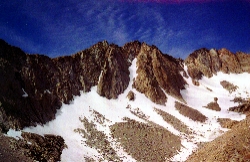
It is difficult to describe the Colorado Trail. Mile for mile, it is probably the most beautiful trail that I have hiked. There are incredible views just about every day.
I have no figures to back me up, but from my own experience, I'd say that about 40% of the trail is on old, abandoned, well graded roads (with a few short walks on pavement), and about 60% is on very well engineered, modern trail. You won't find the "over engineering" of the Pacific Crest Trail here, nor the PUD's (Pointless Ups & Downs) of the Appalachian Trail. The treadway is expertly maintained by volunteers of the Colorado Trail Foundation. We saw far more maintainers than hikers on the CT. These folks (the maintainers) take their jobs seriously, and being a maintainer myself, I can say that they are very good at what they do.
The Colorado Trail is a multi-use trail. Hikers, bicyclists, dirt-bikers, and horses are allowed on most sections (except no bikes are allowed in the wilderness sections). We encountered far more cyclists than hikers. Tolerance seems to come naturally on the CT, and we had no unpleasant incidents with the horse packers or cyclists. Everyone was friendly and treated us well.
We found the trail to be marginally well marked. Occasionally, we'd get to a spot where the route was not clear. At that point, Brawny would usually read the trail description from the guidebook while I got out my compass and looked around for "clues" to our route (water bars, rock cairns, worn treadway, obscure markers or signs, etc.). We never got seriously lost or off-route for long periods. However, it was necessary to stay focused while we hiked. Generally, we found that the trail was better marked than we expected. We feel that the guidebook and a compass were required to stay on-route. We didn't feel that the data book was essential, but it was very nice to have it.
The weather can change very quickly from one extreme to another, especially at the higher elevations. On several occasions, we found ourselves applying sun screen at 11:00 a.m., and then we'd be battling hypothermia and thunderstorms by 3:00 p.m. The thunderstorms were with us just about every day, and they can be a deadly menace above tree line.
When we hiked, the temperatures ranged from 28 degrees to 102 degrees (F). We purposely waited for the warmest time of the year to hike. As a result, we probably had more thunderstorms to deal with, but far less snow. There were small patches of snow at the highest elevations when we hiked, however, snow was never really an issue for us. We didn't carry ice axes, and never felt the need for them.
Insects can be quite bothersome. We each carried bottles of 100% DEET, and we used the DEET often. However, toward the end of August, the bugs were mostly gone except at the lower elevations that were near water. Mosquitoes were the main problem, however, there were biting black flies as well.
Gear & Clothing
Pack:
Because of my back (and because it is the type pack I've used for the past 40 years), I used my Camp Trails external pack frame. Brawny made a silnylon pack for me, and it has been mounted onto the Camp Trails frame. The frame weighs about 2 1/2 pounds, and the pack weighs about 8 ounces. Total weight of my pack and frame is about 3 pounds. I also used one of our ultralight pack covers.
Tent:
We used one of our Tacoma-For-2 Shelters that Brawny made. It is very spacious for 2 people, and it weighs (without stakes), about 2 pounds, 4 ozs. We each have a door and vestible. We did not use a ground sheet or footprint.
Sleeping Bag:
I used my Marmot Hydrogen 800-fill goosedown bag, and it is rated to 30 degrees. I got just a bit cool when the temperature was in the high 20's (coldest temp we had on the Colorado Trail was about 28 degrees). In weather that cold, I wore Thermax long underwear, gloves and balaclava, Smart Wool socks and a fleece hat inside the bag. The Marmot Hydrogen weighs 1 pound, 7 ozs. and has about 4 inches of loft. It was carried in one of our large, silnylon stuff sacks.
Sleeping Pads:
Because of my back problems, I use two sleeping pads, a 3/4 length Therma-Rest strapped to a full length Z-Rest closed-cell foam pad. The Therma-Rest weighs 14 ounces (it is the old model), and the Z-Rest also weighs 14 ounces.
Cooking Gear:
I used a soda can stove, pot support and windscreen that I made, along with a Wal-Mart Grease Pot (used as a cooking pot). Basically, it is the same system that I used on the northern portion of the Pacific Crest Trail. (To see photos of my PCT cookgear, click here .) The cookset weighs about 7 ounces. With matches, Bic-type lighters, 2 Lexan spoons, nylon carrying bag and a week's worth of hexamine fuel tablets, total weight of my cookgear is about a pound. I also carry a 12-ounce capacity recycled plastic sports-drink bottle for alcohol fuel, and it weighs about an ounce.
In addition, I carry a 12-ounce capacity insulated coffee mug with lid (and I don't care how much it weighs!).
Clothing:
What follows is a list of the clothing items I had with me when we finished the trail at Durango in late August:
1 silnylon parka
1 silnylon rain pants
1 Lycra "biker" shorts
1 expedition weight Thermax top
1 mid-weight Thermax bottom
1 pair Thermax glove liners
1 pair Wind-Stopper fleece mittens
1 pair Trail Runner shoes (worn while hiking)
1 pair shower shoes / camp shoes
1 long sleeve Cool-Max T-shirt
1 short sleeve Cool-Max T-shirt
1 lightweight Thermax balaclava
1 polar fleece "watch" cap
1 pair Smart Wool socks
2 pair Wal-Mart men's dress socks (similar to liner socks)
1 pair sunglasses
1 mesh baseball cap
1 pair silnylon booties (new for this year)
Hydration / Water Purification:
2 small plastic bottles for bleach
2 one-and-a-half liter Evian-type water bottles
2 one-liter soda / water bottles
Total weight: About 5 ounces
Hygiene / Sanitation / First Aid:
Hygiene:
Toothbrush & paste
1/8-ounce bottle breath drops
Dental floss
Travel-Pic (metal toothpick)
2 Ounce bottle Isopropyl alcohol
Cotton balls
Cut-down milk jug (used for sponge baths)
Small bandana used as wash cloth
Ultralight pack towel
Analgesic gel
Disposable razor
Small comb
Zip-loc carrying bag (for all except cut-down milk jug sink)
First Aid:
Band-aids
Antibiotic cream
Ibuprofen tablets
Anti-diarrhea medication
Iodine
Hydrogen Peroxide
Cotton balls
Generic Zantac (for indigestion / heartburn)
Tweezers
Zip-loc carrying bag
Sanitation:
Trowel
Toilet paper
2-Ounce bottle Isopropyl alcohol
Cotton balls
Nylon carrying bag
Personal / Miscellaneous Items:
Reading glasses & hard case
Small wallet
Driver's license for ID
Credit cards
Guidebooks / maps
Mosquito headnet
Sun screen
Lip balm
100% DEET insect repellent
Writing material / pen
Camera
1 Black Diamond Ion Headlamp (1 1/8 oz.)
1 Photon light
Avocet watch / barometer
Compass & case
Whistle
Small Gerber lock-back knife (1 oz.)
2 Leki telescoping hiking poles
1 small nylon waist pack
15 ft. nylon cord
Spare cotter pins (for pack & frame)
Therma-Rest repair kit
Sewing needles
Safety pins
1 back brace
Vitamins / medications
My Journal:
July 16 - We arrived in Denver yesterday, and put Brawny's car ("The Blue Rocket") into storage. We then took a cab about 5 miles back to our room at the Motel 6, which is located at the intersection of Wadsworth Ave. and 6th Avenue.
This morning, we were up at 4:30 and walked to the bus stop at 6th & Wadsworth at 5:00. We caught our C-470 bus and had to transfer once and catch the X-63 express bus that goes to the Lockheed-Martin plant near Waterton Canyon. We got off the bus at the Lockheed-Martin plant, crossed the highway and found the Colorado Trail trailhead. We had some bad luck right at the start. Brawny found that one of her nearly new Komperdell telescoping hiking poles was broken. The plastic joint that joins the bottom 2 sections was cracked, and the plastic thread that holds the lower joint in place was split in two. The pole was useless, and had to either be returned to Komperdell for repairs, or thrown away. Brawny placed the pole into a nearby trash can, and proceeded with only one hiking pole.
The temperature was very warm as we walked through Waterton Canyon. Later in the day, a bicyclist told us that his thermometer read 102 degrees. We probably overdid it our first day out, but we hiked 16 miles to the Platte River and made camp about 6:00. Brawny is not feeling well; I believe she is very close to heat exhaustion.
Shortly before we descended to the Platte River, we encountered an apparently homeless and semi-wild black dog on the trail. He really wasn't vicious, but turned into a nuisance. Apparently, he had issues with us invading his territory. He stood on the nearby gravel road and howled at us all night. It was like a scene from "Hound Of The Baskervilles". We felt duly welcomed to the Colorado Trail.
During the night, we had an incident that neither of us is likely to forget soon. I have a very strong startle reflex, which has to do with the fact that I spent a year a Viet Nam with the 25th Infantry Division a long time ago. Anyway, Brawny left the tent to answer a nature call about 1:00 a.m. and I didn't hear her leave. When she re-entered the tent, I didn't know that it was her. I awakened from a deep sleep to see someone or something entering our tent. I glanced over at her sleeping bag, and thought that she was in her bag. At that point, I made a lunge for the "intruder". My hands were outstretched, and I intended to go after the throat of whoever or whatever was entering our tent. Thankfully, there was a lot of moonlight. Just before I made contact, I was able to see Brawny's features and managed to stop in time. She and I have spent hundreds of nights in tents together without an incident like this occurring, and it took us a while to figure out what caused it. In the past, it has always been the sound of a zipper that has awakened me when she left our tent; either her sleeping bag zipper or our tent door zipper or both. However, our Tacoma-For-2 tent has no zippers. And it had been so warm that she had left the zipper on her sleeping bag open, and merely draped the bag over her like a quilt or blanket. As a result, there had been no zipper sounds to awaken me before she left. In the future, we have agreed that she will make sure that I'm awake before she leaves the tent at night.
July 17 - This was another brutally hot day. We hiked for miles through a burned area, and it was my turn to get heat exhaustion. Early in the afternoon, I had to stop and lie down for about 30 minutes in a picnic area. I felt awful. We hiked about 13 miles to Morrison Creek, which was dry. Had to follow it downstream a ways before we could find water.
July 18 - Hiked into the Lost Creek Wilderness and went above 9,000 ft. Weather is a bit cooler. Water has been scarce so far. A loud thunderstorm is right on top of us, but so far, it hasn't rained. Tonight we have a very remote and beautiful campsite amid Lodgepole pines near a small creek.
July 19 - Hiked through a beautiful meadow for several miles that was ablaze with a multitude of wildflowers. Went above 10,000 ft. for the first time. In the afternoon, we got caught in a severe thunderstorm. A tree about 30 ft. from us was struck by lightning. We got away from our packs and hiking poles and got on the ground. Then the hail started, and the temperature dropped to about 50 degrees. We were soaked and shivering when we found a campsite by a nice creek. We got into our tent and heated water for coffee and supper in our vestibles. The ground is covered with hail, and we had to put up our tent on ice. Even though we've changed clothes and had hot drinks and food, neither of us is real warm.
July 20 - It was very cool this morning, but skies had cleared. We hiked about 12 miles to Kenosha Pass. Brawny got us a ride to the small town of Jefferson, where we resupplied and had a town meal. We got a ride out of town back to the trail in the open back of a pick-up truck. However, there was a thunderstorm going on at the time with lots of rain, and by the time we got back to the pass we were both shivering and felt like a couple of drowned rats. We both carried coffee in syrofoam cups back to the trail while riding in the pick-up. When I saw that we'd be riding in the back, we got lids for the cups. Despite the wild ride in the raging thunderstorm, as far as I can tell neither of us spilled a drop.
We got water from the nearby USFS fee-campground, and then camped just outside the campground.
July 21 - Basically climbed all day. Scenery is great, went above tree line and crossed the Continental Divide near Georgia Pass at 11,800 ft. Got off the divide and below tree line, just before a thunderstorm began. Camped on badly sloping site beside the South Fork of the Swan River.
July 22 - Hiked the historic Colorado Trail route to Miner's Creek, avoiding the new route that is on a nearby waterless, exposed ridge. The historic route is at a lower elevation and we had water and many trees to protect us from the thunderstorms.
July 23 - Climbed all morning. Went up to 12,400 ft. as storm clouds gathered. Could see storms in the distance, but we safely made it across the 3 mile treeless section. Descended 3,000 ft. to Copper Mountain and resupplied. Camped with a great group of Colorado Trail maintainers.
July 24 � The route doesn�t waste any time going up after it leaves Copper Mountain. Not long after leaving camp, we were above 12,000 ft. (and above tree line). We took our lunch break near Serle Pass. The pass was absolutely beautiful. The day was sunny and warm, and there was a long, sunny meadow that was ablaze with purple, yellow and white wildflowers.
Later, we encountered Kokomo Pass with its wide, panoramic views. Because of approaching thunderstorms, we were anxious to complete the 5 mile section that was above tree line. We got back into the trees and camped at Cataract Creek just as thunderstorms started.
July 25 � Thunderstorms started in early afternoon, we briefly took cover under trees to avoid going thru a clearing while lightning was popping around us. Talked with a CT thru-hiker named Josh (�J-Bird�), who hiked the PCT last year. Hiked about 13 miles and camped at Wurtz Ditch Creek after crossing Tennessee Pass. Elevations lower today, now at �only� 10,400 ft.
July 26 � Hiked in beautiful Holy Cross Wilderness most of day, but trail was very rocky, and the route was either up or down; not much flat walking. Progress was slow. Clouds formed early and we had thunderstorms most of the afternoon. Had to hike a few extra miles, because the campsites we saw had no water, and the creeks had no campsites. We finally picked up water and carried it. Crossed Sugarloaf Saddle in the rain at 11,080 ft., and found a campsite about a mile later.
July 27 � Hiked in Mt. Massive Wilderness. Thunderstorms again formed early, and the rain lasted until midnight. Regardless of how much it rains and storms in the afternoon and evenings, the weather usually clears by morning. Then, the whole process starts again. We encountered many week-end �peak baggers�. Mt. Elbert is only 60 ft. lower than Mt. Whitney (tallest mountain in the Lower 48), and some also want to �bag� Mt. Massive. We saw several hikers starting up after storm clouds had begun to form, and hoped that they wouldn�t get caught above tree line when the daily fireworks (thunderstorms) started.
July 28 � Awoke to freezing temperatures. Packed up our wet gear and hiked 5 miles to the highway near the town of Twin Lakes. We hitched into town and made a marginal and expensive resupply at the general store. While I was bending over my pack, I had a short, sharp, back spasm in my upper back between my shoulder blades. We had a restaurant meal and walked back to the trail. Shortly after we got back on trail, storm clouds started rolling in. We were completely exposed, and lightning had already started. There was a visitor center nearby for Twin Lakes Reservoir. Brawny climbed over a wooden fence and walked over to the building to see if we could take refuge inside from the storm. Though there were people inside, the building was locked. However, Brawny snagged her pack when she climbed the fence, and ripped open a 5 inch hole. She was pretty upset about it, and we both were upset about being denied shelter from the storm.
We hiked another � mile, and found what appeared to be an abandoned Youth Center. We took refuge under the second story deck and thought we�d be more or less secure. Before the storm got real bad, Brawny made repairs to her pack. However, once the storm got going, it lasted for hours with lots of lightning, rain and 40 � 50 mph winds. Soon, water was flowing down on us from the deck above and we had to change locations. There was a garage next door. It was locked, but there were overhanging eaves on the lee side (out of the wind), so we moved there and waited out the lightning, wind and rain. Later, we walked toward the Twin Lakes Dam. In the past, hikers could walk across the dam, but after 9/11, the bureaucrats decided that in the interest of national security, hikers had to go around. So, we followed a vague and circuitous route behind the dam, finally stopping for the night on a sandy beach beside Twin Lakes Reservoir.
July 29 - Nearly all our gear was wet from the storm yesterday, and it was windy and cold by the lake. My back felt a bit tight and odd while we packed up, but I was hoping for the best when we began to ascend from our lakeside campsite. However, before I�d gone 200 yards, I felt a tremendous jolt of pain in my upper spine. I stopped hiking, straightened my back and tried to take a few more steps. The spasm hit with such force that I momentarily lost control of my arms and legs. I fell backwards to the ground. I had yelled in pain, and Brawny came back down the trail to see what was wrong. I tried to tell her, but I�m not sure I was making any sense. From past experience, I knew that I had to get my pack off and get up and start walking, no matter how much it hurt. I just wanted to curl up in the fetal position and lie down; do whatever it takes to make the pain stop. However, I knew that if I did that, my back muscles would tighten up into a knotted mess and I�d have to be carried out of here on a stretcher. I managed to get my gear off and stand up. I could only tell Brawny that I�d had a back spasm and that I had to walk. I was having problems breathing, because each time I�d inhale, the upper back muscles would constrict and I couldn�t exhale. From previous spasms, I knew that I had to remain calm, avoid hyperventilation, and take smaller breaths. I walked around, and while I was walking I did some shoulder rolls to keep the upper back muscles from constricting further. Brawny was upset and crying. I could barely walk. Our packs were heavily laden with food, and our next resupply point was 70 miles away. I could barely lift my legs, how could I lift my pack and continue? We both looked at the highway across the lake. At that point, we both figured that my hike was over.
About a half-hour later, I was feeling a little better. I could breathe without my back muscles constricting, and it didn�t hurt as much to walk. Brawny and I disagreed over what we should do. She suggested that I leave my pack with her and walk out to the road, hitch-hike to a bus station, get to Denver, pick up our car and then come back. At that point, she would decide whether she�d continue her hike alone, or drive home with me. She understandably thought that my hike was over, as any reasonable person would have. However, I thought that there was a chance that I could continue. I knew that if I walked out to that highway on the opposite side of the lake, that not only was this hike over, but that my long-distance hiking career itself was at an end. I finally put an end to the discussion by saying, �F--- it, lets hike�. Using every trick I�ve learned in the past 25 years about lifting with a hurt back, I managed to get my pack up to one knee. I then painfully lifted it onto my back and hiked away. Brawny followed, but I felt her reluctance and doubt concerning what I was trying to do.
After I�d hiked a mile or so, my back muscles warmed up, and the worst of the spasm was over. However, my back felt very fragile and sore. We managed to hike another 8 or 9 miles to Clear Creek, where we camped for the night.
July 30 - My back felt better. However, I was not sure what was going to happen when I tried to lift my pack. For the rest of this hike, I decided to do 20 minutes of warm-up exercises each morning before I put my pack on. I�ll also do 5 or 10 minutes of exercises after each break during the day. I did my 20 minutes of exercise, but Brawny didn�t want to witness another back spasm, so she hiked up the trail a bit before I tried to lift my pack. I lifted it with one smooth, practiced motion. I waited for the next spasm, but it didn�t come. I caught up to Brawny, who was patiently waiting for me while sitting in the morning sunlight.
We saw some signs posted by the USFS that indicated the Ute Indians had
(a few hundred years ago) stripped away some of the outer bark from the Ponderosa pines we were hiking through. They apparently had used the bark as either medicine or emergency food. The bark had never grown back, however, the trees seemed healthy enough. We hiked about 12 miles and camped at Frenchman Creek.
July 31 � Made a 2,500 ft. ascent to 11,800 ft to a saddle near Mt. Yale, then made a 2,500 ft. descent to a campsite near Cottonwood Creek. Had 2 severe thunderstorms, and got pinned down by lightning in forest cover at the edge of a clearing. We had to wait a while before we could make an exposed traverse down a treeless slope to get to our Chaffee Road campsite. Finally made camp about 7:00. We had to heat water for supper and coffee in our vestibles because of rain.
August 1 - Turned 56 on the trail, and celebrated by hiking 15.5 miles to Chalk Creek. Had a 5.5 mile roadwalk, however, we were pleasantly surprised to find a mini-mart at Princeton Hot Springs. Even though it was not listed in our Colorado Trail guidebook, the store would have been more than adequate for a long-term resupply. Basically, we carried about 6 pounds of food 40 miles from Twin Lakes needlessly. We feasted on hot dogs, chips, unlimited soda refills and ice cream before continuing to Bootleg Campsite, which was several miles down the road.
There were warnings about a camp-mugger bear at the USFS campsite. I couldn�t help but be amused by the father and son who camped next to us. They�d parked their car at the nearby car camping site, and then hauled all their gear to the backpacker�s campground. The father had a high-tech bear detector that worked on batteries. It was about the size of 4 cartons of cigarets stacked together, and featured a motion detector, a floodlight and an alarm. The father said that if the alarm and flashing lights went off in the middle of the night, we were welcome to run back to his car with him and his son. I thanked him, and didn�t bother to tell him that we didn�t run from bears. If one bothered us, we�d come out of our tent throwing, swinging and making noise, ready to defend ourselves, our gear and our food. Brawny and I both wanted to hear the bear-detector go off, but it never did. We hung our food bags in the privy, locked the door from the outside, and got a good night�s sleep in our tent.
August 2 � Hiked through a very warm section of trail with very little water, however, we had beautiful views of Chalk Cliffs. Made a short day of it and camped at Sand Creek. We have only 10 miles to hike to reach Hwy. 50, where we will hitch-hike into the town of Salida to resupply (Salida rhymes with �saliva�, which we never got used to; we kept pronouncing it �sa-lee-da� and the locals kept correcting us).
August 3 � Hiked about 9 miles to Cree Creek. Our food is holding out, but we have cut down on our daily mileages because of my back problems. We are going into Salida tomorrow for a full, 48-hour rest. From past experience, I know that my back will benefit greatly from a hot tub. We picked up water from a small, muddy creek that was running between 2 beaver ponds. Encountered another Colorado Trail work crew, they were very nice to us, and gave us some lemonade. We�ve been leapfrogging with Matt & Sonja, another couple who is hiking the CT. However, because of our plans to spend two days in Salida, we probably won�t see them again.
August 4 � We reached Hwy. 50 shortly after leaving camp. We made a steep descent on a treeless slope. The steep descent is the reason the work crew is here; they said they would complete a trail relocation within a few days, and that the descent would be replaced by a more gentle traverse with a couple of switchbacks. It took about an hour to get a ride. I have a message for the bearded cowboy in the pick-up truck who cheerfully took us 10 miles out of his way to Salida: I enjoyed your conversation and your Jimmy Buffet music. I hope you get that sailboat.
Salida is a large town that has just about everything that hikers need, including a Super Wal-Mart, lots of restaurants and motels, a PO and several places that offer free Internet access (Chamber of Commerce Visitor Center on Hwy. 50 across from the Motel 8, and the library downtown). Carol went to pick up our bounce-box at the PO while I got a motel room for us. I found a great little family operated motel on Hwy. 50 that has a hot tub (Circle R Motel). The total (with tax) for Brawny and me for two nights was $87. Lee & Pam (the owners) were very good to us, and we enjoyed our stay very much. They let us use their washer and dryer for $3. I spent a lot of time in the hot tub. I watched the thunderstorms in the distance that were wreaking havoc in the mountains that we�d just left, sipped my iced soda and felt the hot water working its magic on my back muscles. Life was good, and I was enjoying the heck out of Salida.
August 5 � A day of rest, spent mostly in the Circle R Motel hot tub. We got what we needed out of our bounce-box, mainly sunscreen, hexamine fuel tablets, instant coffee, DEET and medications. We emptied our packs of everything that we felt we could do without, and sent the stuff home in the box. I mailed home my aluminum pot lifter, insulated coffee mug, Nalgene water bottle, knee brace, and ear & neck cape. I�ll use a Wal-Mart insulated plastic container for coffee, and I�ll lift my cooking pot with my bandana or gloves. The Nalgene water bottle (used for dipping in shallow springs) was replaced by a Wal-Mart knock-off Gatorade bottle. I figure all this reduced my pack weight by about a half-pound (the Wal-Mart insulated container warped just a bit from boiling water when I used it the first time. After that, it was fine, and I expect that I�ll continue to use it).
August 6 - We bade farewell to Lee, and Pam took us back to the trail for $10. She cheerfully stopped at Wal-Mart while I ran in to get an item that I�d forgotten. Later, we hiked about 5 miles and camped at Fooses Creek. We are loaded down with 8 days of food for the 99 mile stretch to Lake City. Carol and I joked that this was the �real� Hundred Mile Wilderness, and not the �pretend� wilderness in Maine that the AT goes through.
August 7 - Spacing of water sources made for a short day. We are too loaded down with food to carry water for making dry camps, so we are camping by water each night. We made camp by a small, unnamed spring about 2:00 p.m. a few miles south of Marshall Pass. We had crossed the Continental Divide at 11,900 ft. earlier in the day. Yesterday was the first day that we hadn�t had rain since our hike began. Dirt-bikers (on small motorcycles) are legal in this section, and we encountered a large group of them. They seemed to be truly awed by our hike, and had many questions. The leader took our photo, as evidence that bikers and hikers can get along and peacefully co-exist on the trail.
August 8 � The thunderstorms have abated somewhat, the days are a bit shorter, and it is not quite so hot during the day now. Views to the east today were probably about 100 miles, and I could see no signs of civilization. We hiked about 12.5 miles and camped in a meadow at 10,250 ft. near Tank 7 Creek. The creek apparently got its odd name in the 19th century when there was a water tank near the creek that the railroad used. The afternoon was pretty, and I sat outside listening to hawks calling, and watching the chipmunks scurrying around. Our meadow has numerous Spruce and Juniper trees, and lots of purple, white and yellow wildflowers.
August 9 � Weather is definitely cooling. According to my Avocet watch/barometer/thermometer, it was 32 degrees inside our tent this morning just after daylight. Brawny shook the water off of our tent just as a bunch of cattle were walking by. She caused a wild stampede, as the cows ran blindly up the side of the mountain. We hiked above 11,000 ft. most of day in meadows near Cameron Park and Sargent�s Mesa. We camped at beautiful Baldy Lake, which is � mile off-trail, but the only water source for miles. James & Shelly, another couple we�ve been leapfrogging with, also camped at the lake. Water is scarce in this section, and water is now dictating how far we hike each day.
August 10 � I awoke at 1:30 a.m. having breathing problems. It felt like someone had their foot on my chest. I had trouble taking deep breaths, and had to get up and walk around outside for a while. However, there was a nearly full moon, and it cast eerie shadows on the water and on the cliffs above the lake. A few hours later, I was fine. Brawny has had similar breathing problems from time to time, and we attribute it to the altitude. Later, we hiked about 14 miles, and got cattle-tainted water from Lujan Creek. This was some of the worst water that we've ever had to use. Not only were there massive amounts of cattle droppings along the banks of the creek, but there were droppings in the creek as well. We carried the water a ways and found a small, sloping campsite up on a little knoll in some ancient Spruce trees. The campsite really wasn�t much, but it was the first one we�d seen in hours and we were glad to have it.
August 11 � Hiked in 9,000 + ft. elevation meadows most of day. Picked up 5 quarts of water at Los Creek at lunch and hauled it all afternoon. Made a dry camp. We should be finished with this scarce water section tomorrow. Had to take refuge in trees near an old cabin due to a 2 hour thunderstorm in the afternoon. Camped in a beautiful meadow after hiking about 5 more miles. There is a lot of sage here, and it reminds me of the Pacific Crest Trail. I love the smell of it (the sage), however, I�m allergic to it.
August 12 - We met Cathy, a woman who has been hiking solo on the CDT since April. She is going after the Triple Crown. Hiked in La Garita Wilderness most of the day. We reached Cochetopa (not sure about spelling) Creek at lunch. Hiked til 4:00, when the thunderstorms forced us away from the creek, up into the trees. Have a nice campsite at the edge of a meadow.
August 13 � A very hard day with lots of elevation gain and loss and awe inspiring, grand scenery all around. The area around San Luis Peak and San Luis Pass is breathtakingly beautiful. Went up to 12,600 ft. Brawny is not feeling well, probably due to the god-awful, cattle-polluted water that we�ve been drinking. However, we are still hiking, so the bleach we are using to purify water must be working (like it has since 1992, when I gave up on filters). She feels that she has been over-compensating for the bad water by adding too much bleach to her water, and that the extra bleach is what is upsetting her stomach. Town tomorrow! We are pigging out on our remaining food. The long, remote, 99 mile stretch from Salida to Lake City is almost done.
August 14 - This morning while heating water for breakfast, I watched the sun light-up the rock cliffs near our Mineral Creek campsite. Later, made a 1,000 ft. climb before rounding a cirque canyon. We then descended to the massive Snow Mesa at 12,000 ft. Walked across the 5 mile mesa before descending to Hwy. 149 and Spring Creek Pass. Two hikers we�ve been leapfrogging with ended their hike at the pass. We were hitch-hiking (without success) when they arrived. I didn�t try yogi-ing a ride, I just asked them if they had a car parked at the pass. When they said that they did, I asked if they would take us to Lake City. They agreed. We got an expensive room at the Silver Spur Motel. The room was very basic; didn�t have air conditioning, fans, telephone or even screens on the windows. However, there was cable TV and lots of hot water. Had a nice meal after resupplying. While we were having supper at the restaurant, someone took a flash photo. To Brawny and me, it looked just like a lightning flash. She almost came out of her chair, and I nearly dived under the table. We got some strange looks from the other customers, but no one said anything.
August 15 � Had an expensive and not very good time in Lake City. Neither of us slept well, with all the town noises waking us on a regular basis. Couldn�t hitch a ride out, finally paid a local $20 to take us back to Spring Creek Pass. Hiked about 5 miles across Jarosa Mesa at 11,800 ft. before thunderstorms forced us to take a 1.5 mile side trip to get down to tree line. Found a campsite and water just before storms hit.
August 16 � Storm clouds formed early. We got caught in a thunderstorm in the open with severe lightning at 12,200 ft. just north of Ruby Lake. We had discussed what we would do if this ever happened, and the planning paid off. The plan called for us to drop our packs and hiking poles. While Brawny put her rain cover on her pack, I'd get our tent out, then hand it to her and direct her to a low spot. While she was spreading out the tent, I'd put the rain cover on my pack, and then join her. We'd drape the tent over us while we laid flat against the mountain.
Today, we had been hiking in hail for about 30 minutes when there was a distant clap of thunder. We kind of looked at each other and kept hiking. About 1 minute later, there was a flash that seemed to light up the entire area around us. Immediately following the flash of lightning, there was a deafening explosion of thunder. We had our packs off and hiking poles on the ground in about two seconds. Less than 30 seconds later, we were away from our packs and poles and lying flat against the grassy slope with our tent draped over us. We spent 1 � hours like that, with lightning popping all around us. Then the hail stopped, and it started snowing. After snowing for a while, it changed to rain. We almost bailed and descended to tree line again, but we decided to continue. We finally topped out at 13,250 ft. near Coney Peak, the high point of the Colorado Trail. We descended past several old mines to beautiful Lost Creek Valley and found a campsite.
August 17 � Awoke to rain, but it cleared shortly after we began hiking for the day. Made a climb to 12,920 ft. at the end of the valley we had been walking through. It was cold and windy, and we had to stop and put on more clothes. Forded the Rio Grande River, then headed up a tributary on a jeep road. We were supposed to go through abandoned Beartown, but we never did see it. Camped early, above Bear Creek. A large group occupied the campsite we intended to use, so we looked around for another place to camp. Found a beautiful secluded site, complete with 2 chairs and a picnic table that someone had hauled in and left behind.
August 18 � Packed up in light rain and ascended to the Continental Divide. We encountered a herd of sheep and were charged by 2 enormous dogs that were guarding the sheep. One was the size of a Great Dane, but looked like a German Sheperd. I finally managed to chill them out, and they left us alone. Descended into the beautiful Elk Creek Gorge. The trail was very exciting and interesting. A small, steep section had been blasted out of the cliff face. I expect it had been done back in the mining era, since it was a lot wider than necessary for hikers. There was an old mining cabin still intact, and many abandoned mine shafts that had been dug into the sides of the mountains. Descended all day amid beautiful views, dropped 3,500 ft. and camped at the Animas River. The obligatory thunderstorm showed up just before we got into our tent.
August 19 � Packed up our wet gear in freezing weather, then climbed about 1,500 ft. to reach Molas Pass. Neither of us wanted to hitch-hike into Silverton to resupply, so we decided to make do with the very limited supplies that were available at the campground store. Mainly, we�ll be living on candy bars, chips, cookies and beef jerky for the next 5 days. However, the woman who runs the store said that some other hikers had left a bag of dehydrated, refried beans and some tortilla shells. She gave them to us, and we�ll use them for suppers for 3 nights. Then we�ll have to get creative. We camped near two alpine ponds in a valley at an elevation of 11,500 ft. The evening was clear, and completely free of storm clouds. I marveled at the beautiful scenery that surrounded us.
August 20 - Temperature was 28 degrees inside our tent just before sunrise. We saw several elk and deer shortly after getting on trail. Hiked 15 miles and camped at Celebration Lake. Only 52 miles left before we end this year�s hike in Durango. Camped again above 11,000 ft. Brawny packed in about a half-dozen grasshoppers after they hitched a ride inside our tent. They were pretty much chilled out, and didn�t hop around too much at Celebration Lake. Neither did we.
August 21 - Reached Blackhawk Pass about 11:30 a.m. We arrived at the pass about the same time as a thunderstorm. Storm clouds were gathering when we went above tree line. I figured we�d be above tree line for about 30 minutes on each side of the pass. It was a bit risky, but we knew that if we waited for the storm to pass, that we could still be waiting at 7:00 p.m. So, we decided to go for it. There were several claps of thunder and some lightning in the distance, but nothing close. We made it up and over, and were very relieved to get back to the cover of trees on the far side of the pass. We met a couple who were day hiking, and they gave us some fruit, the first fiber we�d had in about two weeks. They also gave us some important info concerning Durango. They said we could rent a car downtown at the Doubletree Hotel, we didn�t have to go all the way to the airport. Since we could walk directly to the hotel, and wouldn�t have to take a bus or cab to the airport, this tidbit of information saved us several hours of travel time, and some money as well. Picked up water, the last water that we may see until we get to Taylor Lake, which is 18 miles away. Carried our water about 3 miles and made another dry camp.
August 22 - We had a powerful storm last night. Our tent held up well to wind gusts of at least 35 � 40 mph. I usually hang up my hiking clothes outside at night. Last night, the wind knocked my shorts off a tree limb onto the ground. At that point, a critter or critters had a field day with them. They were literally chewed to bits this morning. I�d heard some small animal scurrying around outside during the night (probably a chipmunk), but hadn�t thought much of it. Luckily, I have a spare pair of shorts that I normally wear in trail towns with my parka while my other clothes are being washed. Hiked 16 miles to Taylor Lake, and the last 4 miles were above tree line. The views were spectacular, but as usual, storm clouds were forming. We hiked as quickly as we could, and made the descent to Taylor Lake and tree line about an hour before the storm hit. The wind was just as bad as the previous night, and it rained hard for most of the night. We are ready to be done with this.
August 23 - It was partially clear when we packed up this morning, but storm clouds were already forming by the time we began hiking. By the time we reached Kennebec Pass, I knew we were in for some rough weather. The storm actually held off until about 2:30 p.m. Then there was thunder, the air cooled considerably and the wind picked up. Those are the 3 signs in Colorado that you are in for some bad weather. The guidebook had warned us that on this last section of the Colorado Trail, camping was scarce. It said that the creeks had no campsites, and that the campsites had no water. However, we are pretty good at finding campsites with water, and didn�t believe that today would be an exception. Today was different, though. By the time we reached Junction Creek about 6:30 p.m., we�d just about given up on finding a place to camp. At that point, the storm had been going on for over 4 hours, and the thunder, lightning, wind and cold rain showed absolutely no sign of letting up. Normally, there are probably a couple of campsites by the creek, however, they were all under water. We hiked past the muddy mess at the bottom of the gorge, then ascended to a point that put us a couple of hundred feet above the creek. By this time, it was almost 7:00 p.m., and we�d hiked about 20 miles. We were only about 2 miles from the end of the Colorado Trail at Junction Road. We were thinking about hiking there, and making a desperation camp at the trailhead parking area. However, we saw a wide area beside the trail that was just large enough for our tent. Two feet from my side of the tent, there was a 200 ft. drop off. We briefly discussed it, and decided to make camp in this muddy mess in the pouring rain. We knew that if we could just get our tent up, that we would be relatively comfortable inside for the duration of the storm. It seemed to take longer than it should with more aggravation than we expected (with tent stakes pulling out in soft ground, and other stakes refusing to go into hard ground), but finally it was done. We managed to change clothes and use our small soda can stoves in the vestibules of the tent to heat water for supper and coffee. Besides being a muddy, soggy mess, it really wasn�t that bad. We knew that we would most likely spend the next night at a motel in Denver. We drifted off to sleep while listening to the sound of rain water hitting our tent, and the distant gunfire of some locals, who apparently were celebrating a late summer Saturday night.
August 24 � We heated some water for coffee and breakfast, then packed up our soggy, muddy gear as soon as it was light enough for us to see. The weather had finally cleared, and we quickly hiked the 2 miles to the southern terminus of the Colorado Trail. Our hike ended here for this year, and we needed only to hike about 3 miles on Junction Rd. to reach downtown Durango. We found the Doubletree Hotel and made arrangements to pick up a rental car. We had some time to kill, and went to McDonald�s for breakfast. We then went to Albertson�s and bought some snacks for the drive to Denver, where we would pick up Brawny�s car the next day and begin the long drive home.
We hiked for 40 days this year, and covered about 468 miles. On all but 3 days, we experienced rain, sleet, hail and/or snow. We got awfully tired hearing about the �drought� in Colorado.
In completing the Colorado Trail, we also hiked about 350 miles of our Continental Divide Trail route. I�ll probably resume my hike of the CDT in 2004 (or later). This year�s hike was beautiful, challenging and exciting, and I�m very glad that Brawny and I were able to complete it as planned. However, right now we are both looking forward to being home.
--Rainmaker
Getting There (And Getting Out):
Because of the higher altitudes and steeper sections at the southern end of the trail, it is highly recommended that hikers begin their trek in Denver and hike south to Durango.
Those starting in Denver will need to get to Waterton Canyon, which is located on the south side of the city. We stayed at the Motel 6 that is located at Wadsworth Blvd. and 6th Ave. We caught the C-470 (I'm not sure about this number) bus at the intersection just after 5:00 a.m., then transferred to the X-63 Express bus that goes to the Lockheed-Martin plant. We got off the bus at the Lockheed plant about 6:15, crossed the highway and walked .3 mile to the trailhead.
When we finished the trail near Durango, we walked 3 miles to town on Junction Road. Durango is a large town, and you won't have any problems finding what you need (including an airport). The Doubletree Hotel downtown rents cars.
Additional Info & Guide Books:
For additional information, I'd suggest visiting the Web site of the Colorado Trail Foundation .
I'd also suggest buying and using the guidebook and data book. We used both on our hike. The guidebook is a bit heavy and glossy for thru-hikers, but it is the best publication that is available for the Colorado Trail. The maps in our guidebook were good, but they were not topo maps, which disappointed us. However, the Colorado Trail Foundation now offers a Colorado Trail Topo Map Book at their site. To see additional information concerning this book (and their other publications) visit the Colorado Trail Foundation Store.
Their data book is excellent, though our edition did contain a few errors.